

This Yosemite itinerary and guide is perfect for first-timers who want to know exactly where to see the best viewpoints, where to stay, how to get to Yosemite plus 5 top Yosemite travel tips!
Of all the national parks in California, Yosemite takes the cake. With over 800 miles (1,287 km) of hiking trails along glacier-cut rock formations, stunning panoramic vistas punctuated by countless waterfalls visiting Yosemite is a must. For tips on visiting the other 58 national parks in the USA, check out my guide here.
What’s included in this Yosemite Itinerary
- Map of Yosemite Itinerary
- What is Yosemite National Park
- What does ‘Yosemite’ mean?
- Top 8 Famous Attractions & Best Things to See in Yosemite
- Top 10 Best Viewpoints to Visit in Yosemite
- Top 5 Tips for Visiting Yosemite National Park
- Best Time to Visit Yosemite National Park
- Yosemite Itineraries – What to do in 1, 2, 3, or 4 days
- Where to Stay in Yosemite National Park
- Accommodation: Where to Stay Yosemite Valley
- How Much Does it Cost? Yosemite National Park Fees
- Getting Around Yosemite Valley
- How to Get to Yosemite from San Francisco
Map of Yosemite Itinerary
Want to know where you’ll be going? Take a look at the detailed map below.
Click on this interactive map and see where this itinerary will take you. I’ve created this map using Google Maps which you can save and use as you travel around.
Orange Pins – 10 best viewpoints in Yosemite
Blue Pins – 8 famous attractions in Yosemite
Pink Pins – Extra time
What is Yosemite National Park?
Yosemite National Park is located in California’s Sierra Nevada mountains. Mariposa Grove and Yosemite Valley were first protected in 1864 by President Lincoln who signed the Yosemite Land Grant on June 30. It wasn’t until 1890 that the rest of Yosemite’s ecosystem was protected thanks to thanks to John Muir’s passionate writing about the area.
The mountains are calling, and I must go.
What does ‘Yosemite’ mean?
The name ‘Yosemite’ (yo-SE-mea-tea) comes from the neighbouring Indian tribes who feared the tribe who lived in Yosemite Valley. These neighbouring tribes called this tribe Yohhe’meti (Southern Miwok) or Yos.s.e’meti (Central Miwok), which literally means “those who kill”.
The Yosemite people called Yosemite Valley Awooni or Owwoni meaning “large mouth.” The Yosemite people called themselves Ah-wah-ne-chee, or “dwellers of Ahwahnee.” Ahwahnee originally referred to the largest and most powerful Indian village in the valley. Eventually, the word also came to mean the entire valley.
Top 8 Famous Attractions & Best Things to See in Yosemite
Yosemite is home to many famous landmarks, heck, even Apple has named several of their operating systems after them including El Capitan, Sierra, High Sierra, and of course, Yosemite.
Here are top 8 of the most famous landmarks in Yosemite.
1. Half Dome
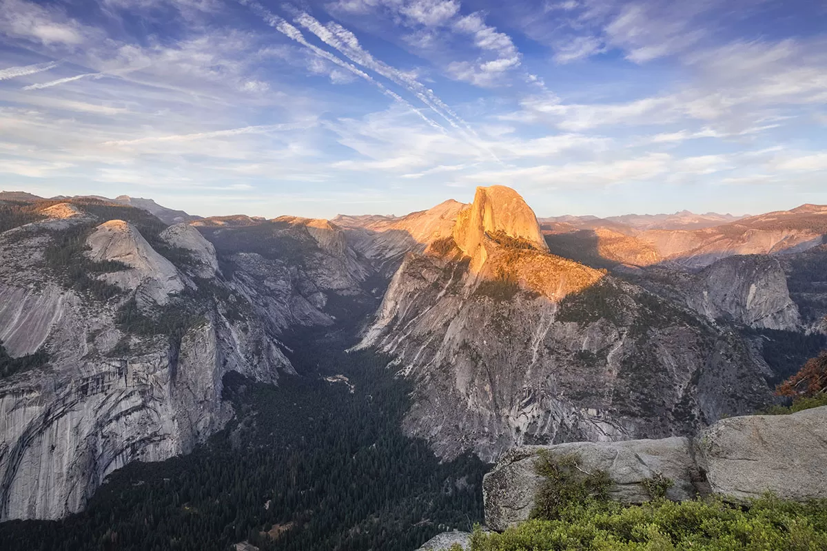 Rising nearly 1,524 meters (5,000 feet) above Yosemite Valley and 2682 metres (8,800 feet) above sea level, Half Dome is the cornerstone of Yosemite National Park. Did you know it even inspired the design of the North Face logo?
Half Dome is visible throughout Yosemite, so you’ll have multiple opportunities to take in its glory. If you have a spare 10-14 hours, you can even hike to the top or rock climb up its flat face.
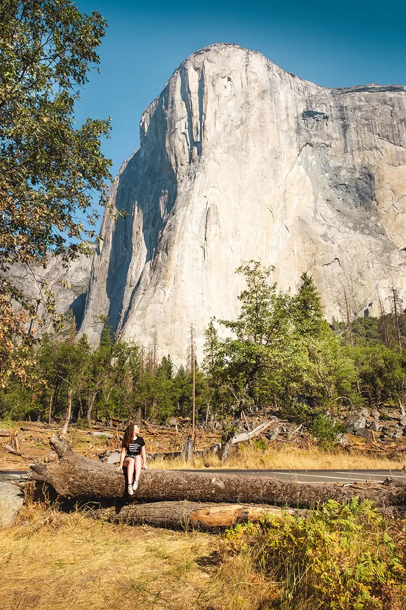
2. El Capitan
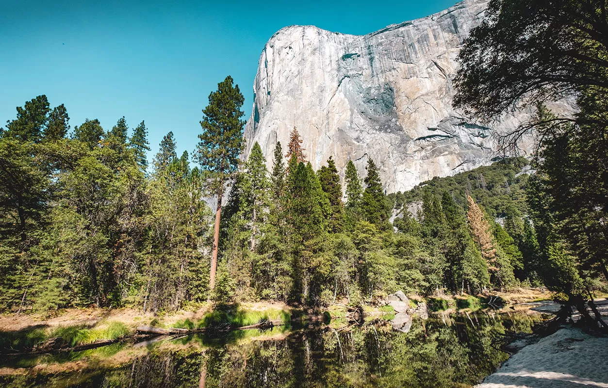
Looking up at El Capitan
If you’re a Mac user like me then you might recognise this iconic rock formation from your default desktop wallpaper. This is none other than El Capitan, (Spanish for The Captain, or The Chief) the world’s largest exposed granite monolith which stands 3,000 feet (900 m) high from base to summit.
El Capitan has become even more famous (if that’s possible) since National Geographic released the documentary ‘Free Solo’ following the American rock climber Alex Honnold who was the first person to successfully free climb up this famed monolith!
3. Yosemite Falls
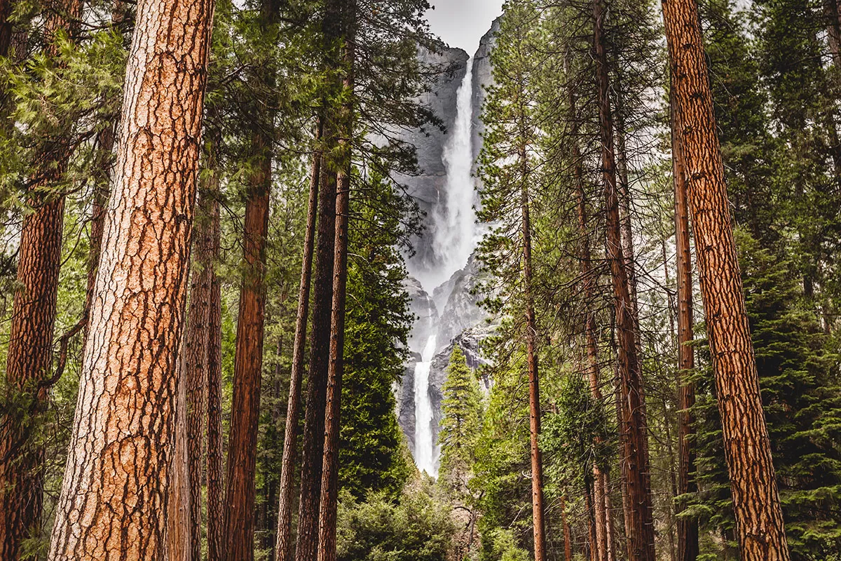 Yosemite Falls is the world’s fifth tallest waterfall and made up of three separate falls. Dropping over two mighty leaps with cascades, Yosemite Falls is the highest waterfall in Yosemite National Park, dropping a total of 2,425 feet (739 m) from the top of the upper fall to the base of the lower fall.
Peak runoff typically occurs between May and June. After which, it can be reduced to a mere trickle or be bone dry by August.
4. Bridalveil Falls
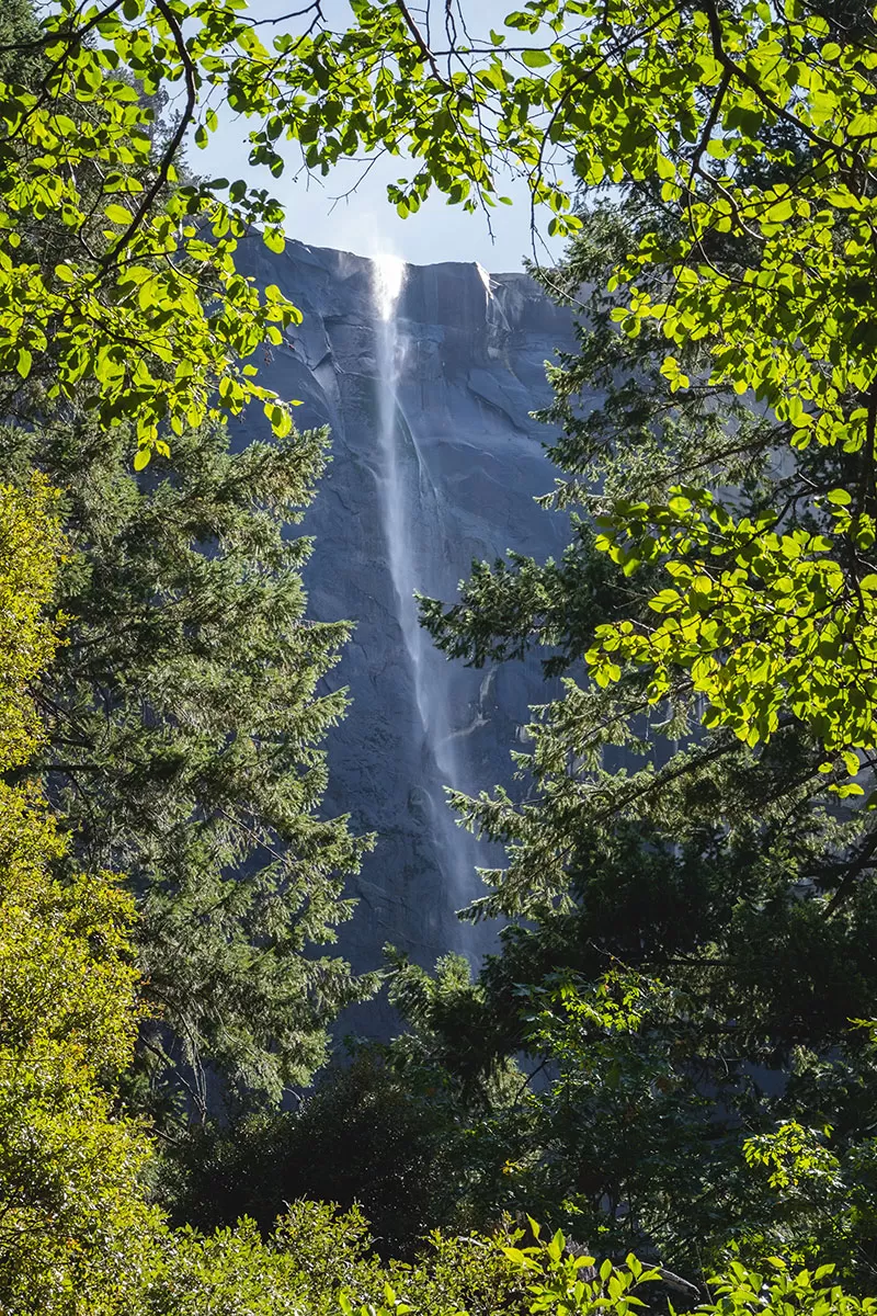 Bridalveil Creek leaps into Yosemite valley from the edge of the precipice. When there is enough wind or the flow is light, the falling water blows sideways and may not even reach the ground. Because of this, the Ahwahneechee Native Americans called this waterfall “Pohono”, which means “Spirit of the Puffing Wind”.
For a close-up view of this often-windswept waterfall, (from which it’s name was inspired) there is a short trail that will lead you right to the base of Bridalveil Fall. Tunnel View also provides excellent views,
5. Vernal Falls
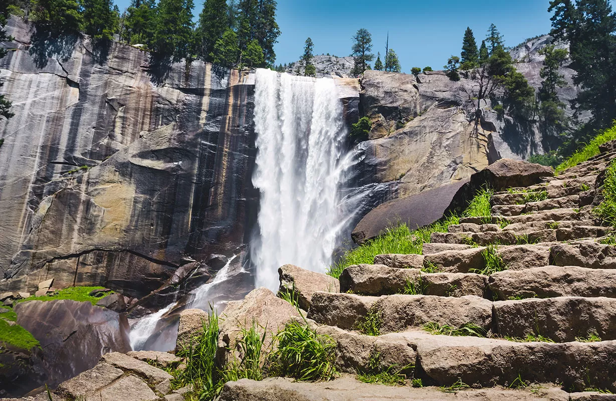
Vernal Fall staircase on Mist Trail
Vernal Fall is a 317-foot (96.6 m) high waterfall on the Merced River and is clearly visible, albeit from a distance, from Glacier Point, or up close along the Mist Trail.
The Vernal Falls flows all year long, but by the end of summer, it reduces quite a lot in volume causing it to split into multiple streams rather than a single curtain of water.
Before it was named Vernal Falls, a term reference Spring, it was called Yan-o-pah meaning ‘little cloud’.
6. Nevada Falls
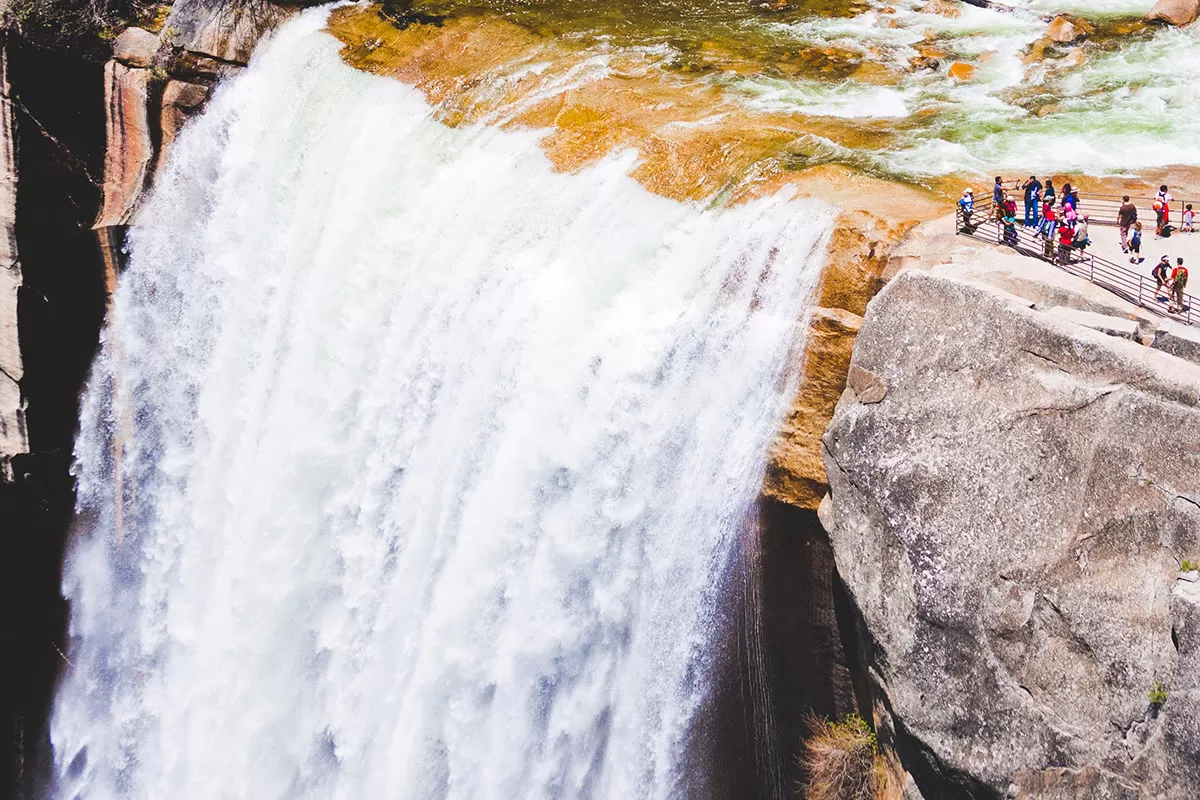
Nevada Falls from John Muir Trail
Located above Vernal Falls is Nevada Falls and reaches 594-foot (181 m) high. The waterfall is famous for its bent shape caused by the lower third of the current hitting a steep slick-rock slope and changing its course. The name Nevada, meaning ‘snowy’ in Spanish, gets its name from the whitewater appearance of the waterfall and the amount of mist is produces.
Nevada Falls can be seen on both the Mist and Muir Trails which are a 7 mile (11km) round- trip hike to reach the top. Both Vernal and Nevada Falls are also visible from Glacier Point.
7. Tuolumne Meadows
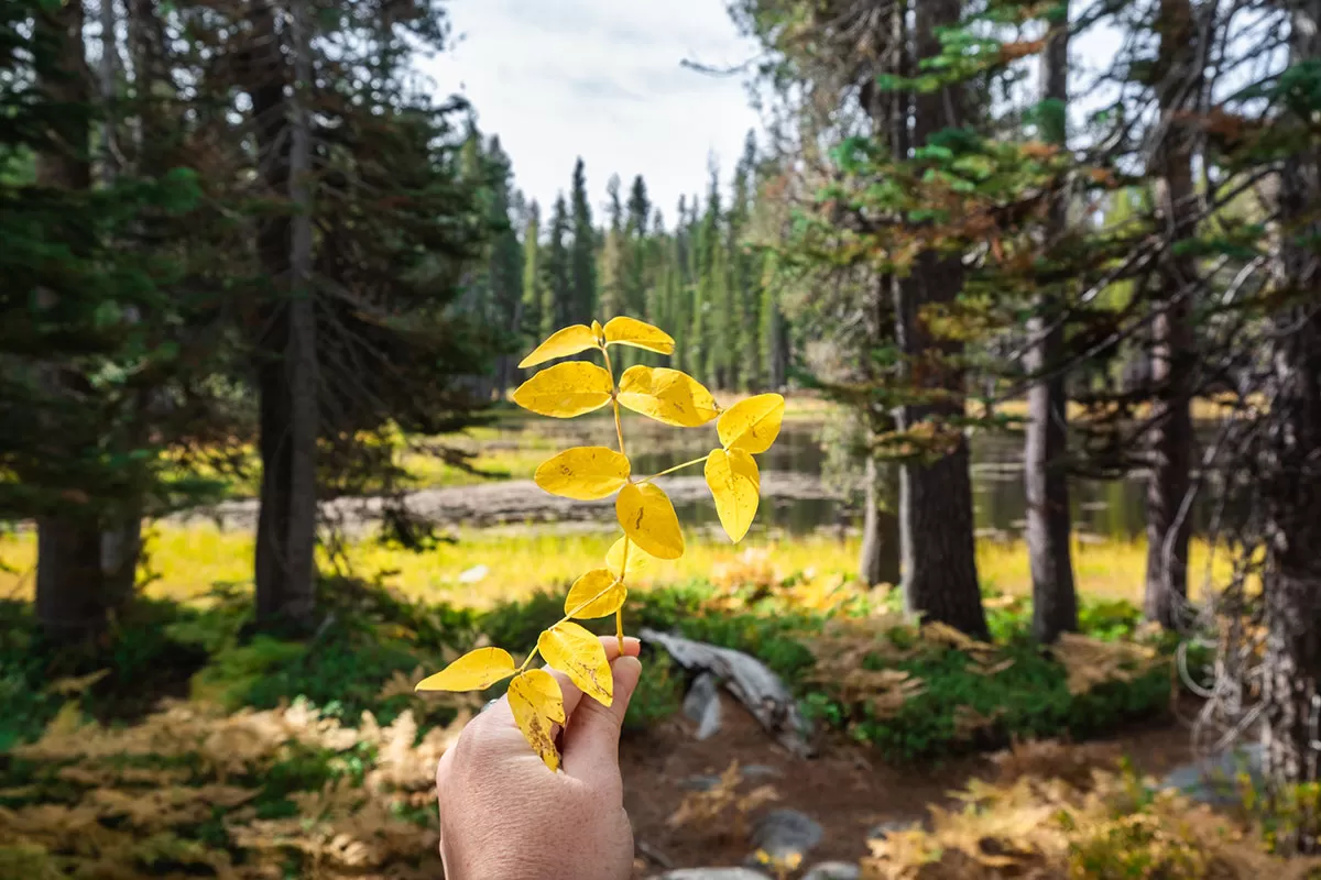
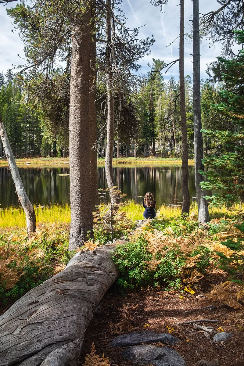
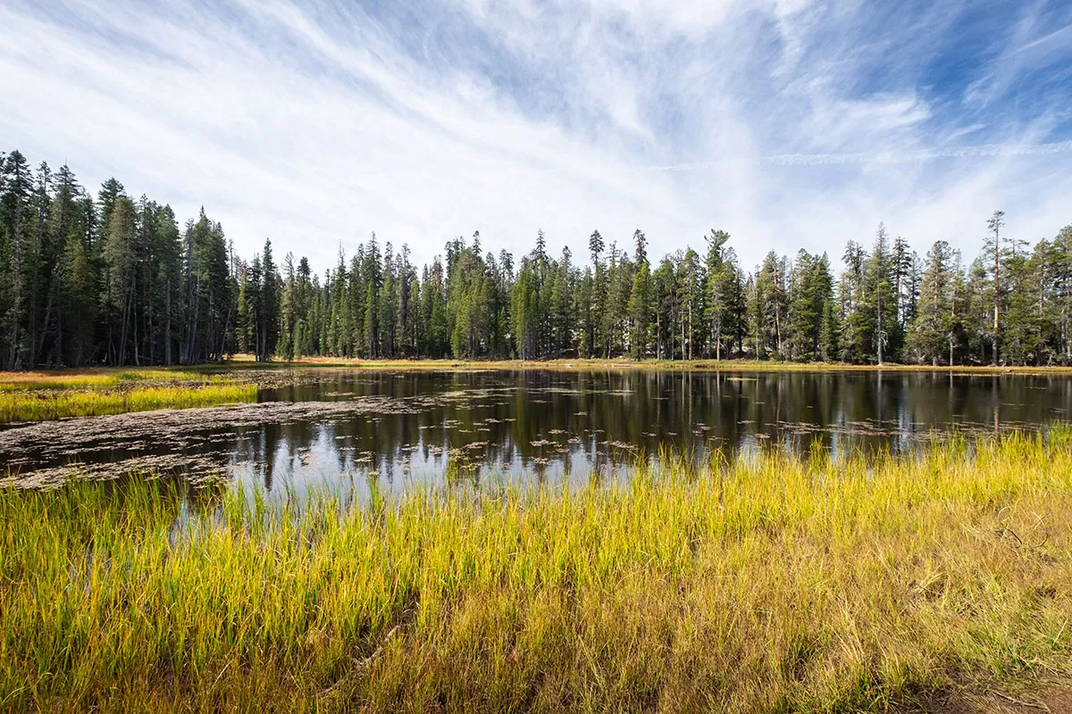 Set against a backdrop of glacially carved domes and towering mountain peaks Tuolumne Meadows is one of the largest high-elevation meadows in the Sierra Nevada located at an elevation of 8,600 feet (2621 m).
Quietly weaving through this colourful landscape with various plant species is Tuolumne River which cascades over the granite river bottom.
Since Tuolumne Meadows is located outside of Yosemite Valley on Tioga Road, fewer people visit the area which helps it to maintain its tranquillity.
8. Tenaya Lake
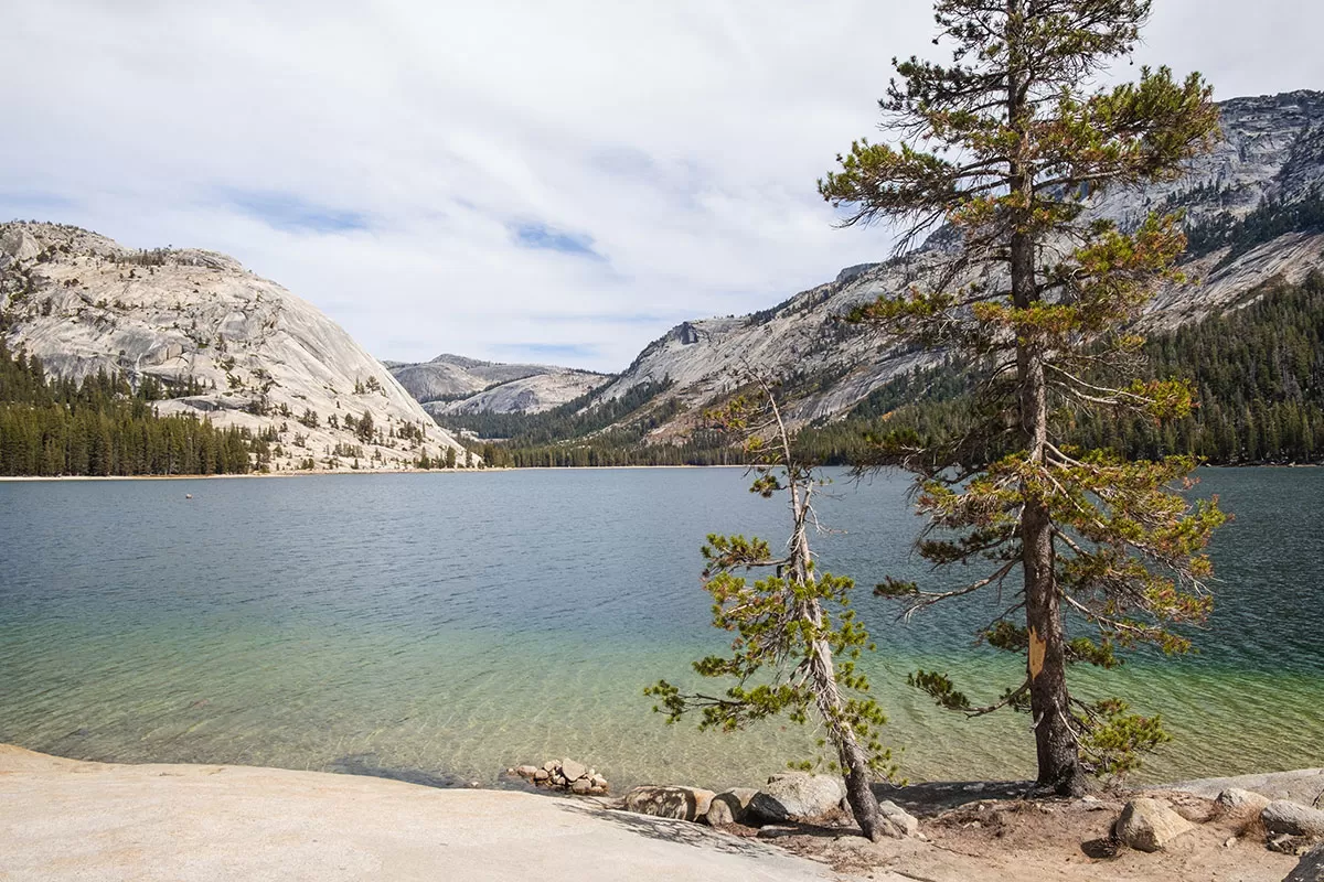 Tenaya Lake is referred to as the “Jewel of the High Country” with its inviting blue water and idyllic location surrounded by huge granite domes and thick wilderness as far as the eye can see.
Since it’s located on Tioga Road, this is a popular spot during the Summer months for kayaking, boating, swimming and even sunbathing.
Now that you know what to see in Yosemite National Park, here are the best ways to see them.
Top 10 Best Viewpoints to Visit in Yosemite
There are plenty of ways to see Yosemite’s majestic landscape, either from the side of the road or after hours of hiking. I’ve cherry-picked 10 of the absolute best (and easy to reach) viewpoints from which you can see each of Yosemite’s attractions mentioned above.
Here are best viewpoints in Yosemite first-timers should not miss.
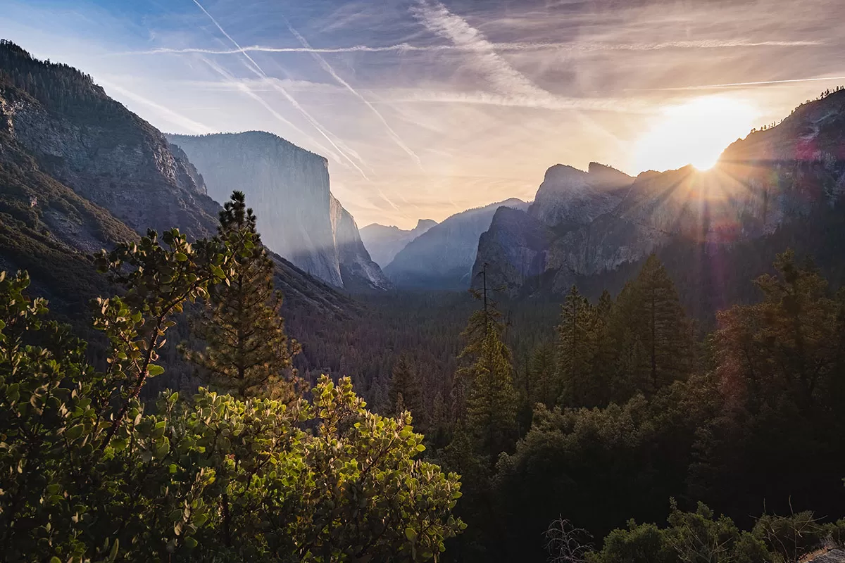
1. Tunnel View
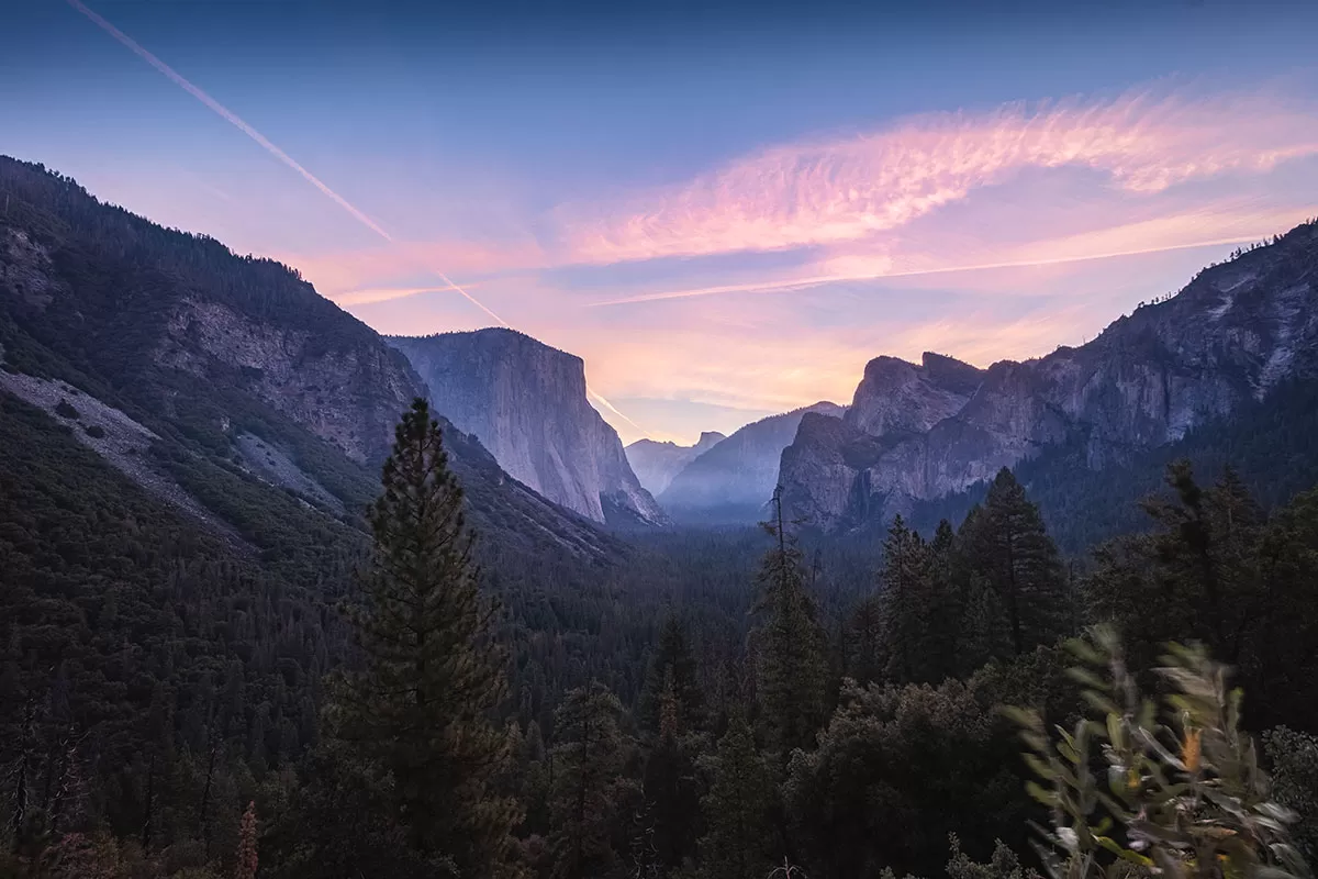
Tunnel View before sunrise
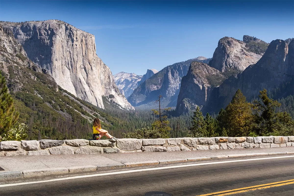
Tunnel View in the afternoon
Tunnel View is by far the most well-known and iconic spot to see Yosemite Valley. It’s also super easy to get too. It might be called Tunnel View, but don’t be fooled, the view itself is from the carpark, not from the nearby tunnel!
From Tunnel View, you’ll see El Capitan on the left and Bridal Veil Falls on the opposite side. Half Dome is also visible in the in the distance. If you’re up for it, I highly recommend coming here early to watch the sunrise. If you just miss sunrise then you’ll only get a whole lot of sun glare. Come back in the afternoon when the sun is high in the sky or behind you.
Tunnel View just after sunrise
How to get to Tunnel View
Tunnel view is located on the east end Wawona Road/Highway 41 just over 10 minutes away from Yosemite Village. It’s located on the side of the road so you can’t miss it.
2. Glacier Point and Sentinel Dome
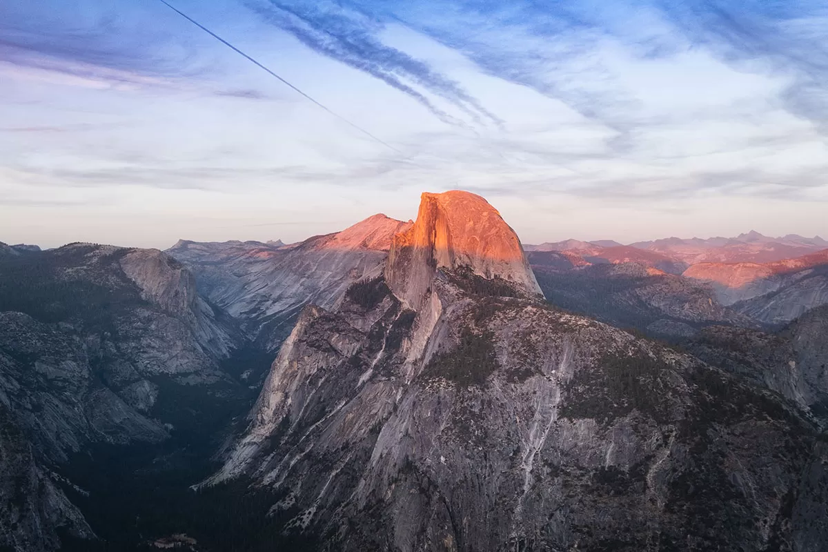
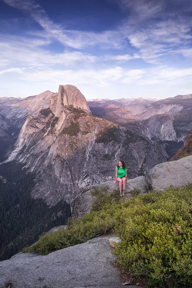 The main drawcard to Glacier Point is its epic view of Half Dome. If you watch the sunrise at Tunnel View, make sure you head to Glacier Point to watch the sunset! As the sun lowers in the sky, it slices Half Dome in two with its ultra bright pink light. Just. Wow!
Glacier Point offers wonderful panoramic views of Yosemite’s mountainous landscape and has clear views of both Vernal and Nevada falls.
This is a very popular viewpoint so parking spaces are snapped up fast. In some cases, they will close the road until space opens up. Allow extra time for a space to open up so you don’t miss out.
For similar views and fewer crowds, take the Sentinel Dome trail head located off Glacier Point Road. This short hike is only 2 miles (3.2 km) round trip.
How to get to Glacier Point
To get to Glacier Point, drive to the end of Glacier Point Road. It’s a 45-minute drive from Tunnel View.
Winter Season: Glacier Point is open from late April to early November. Glacier Point Road is closed during Winter due to heavy snowfall. Alternative ways to see Glacier Point is by hiking 20 mile (return) to Glacier Point or stopping by Badger Pass Ski Area located on Glacier Point Road. This is the only part of the road which is ploughed.
3. Washburn Point
For a different angle Half Dome, compared to that at the more popular Glacier Point viewpoint, stop by Washburn Point and enjoy similar views without the crowds. Yup, you’ll still see Nevada Falls, and Vernal Falls too!
How to Get to Washburn Point
Washburn Point is located on Glacier Point Road, 0.7 miles before you arrive at the Glacier Point parking lot. We walked between the two viewpoints and enjoyed ever-changing views of Half Dome. It’s a mostly downhill walk if you go from Washburn Point to Glacier Point.
4. Olmsted Point
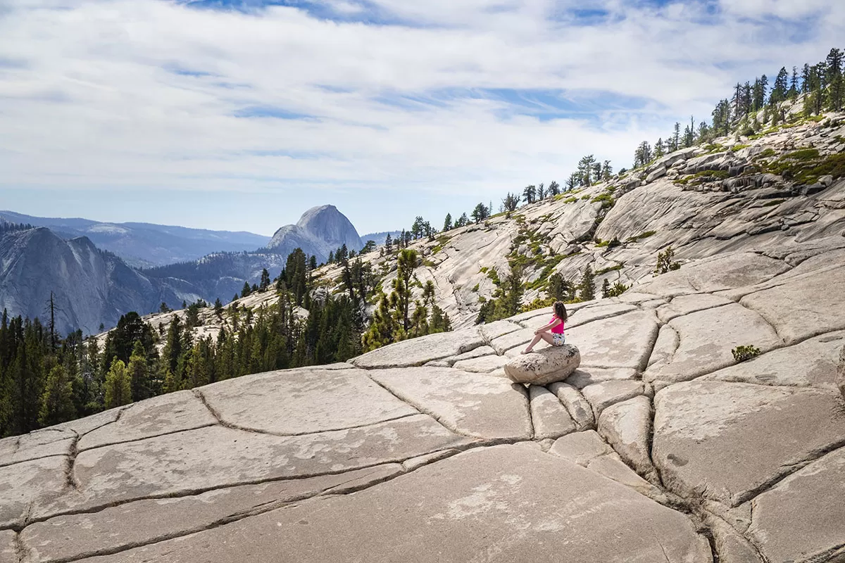
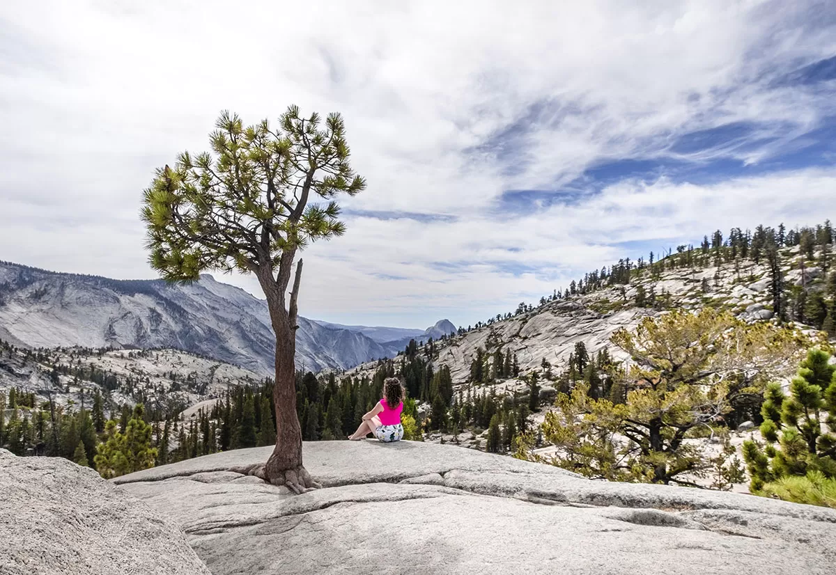 Overlooking Tenaya Canyon, Olmsted Point is another famous viewpoint, this time with views of the northern side of Half Dome. Scattered all over the granite slopes are large boulders which were left when the last glacier came through.
Olmsted Point was named after Frederick Law Olmsted and Frederick Law Olmsted, Jr. who, in the 1860s was a key figure in protecting Yosemite Park. Olmsted worked alongside Senator John Conness of California to preserve Yosemite Valley and Mariposa Big Tree Grove as public lands under the protection of the State. This was the first part of land that was set aside by Congress for public use, which later became the National Parks.
How to get to Olmsted Point
Olmsted Point is located on Tioga Rd off State Highway 120 and about 90 minutes from Yosemite Village. This viewpoint is located on the side of the road and has a small parking area. The Tioga Road is open from late May or early June to November.
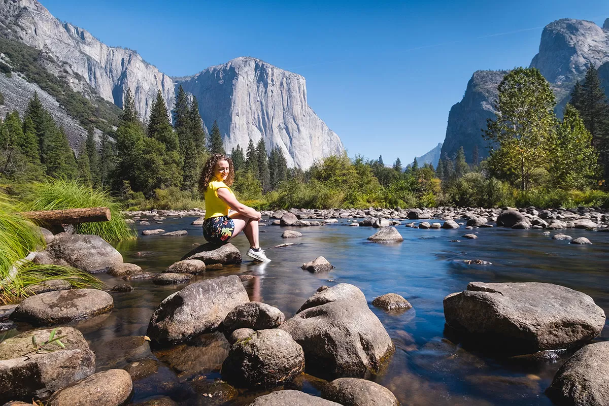
5. El Capitan Bridge / El Capitan Meadow
Dwarfed by El Capitan
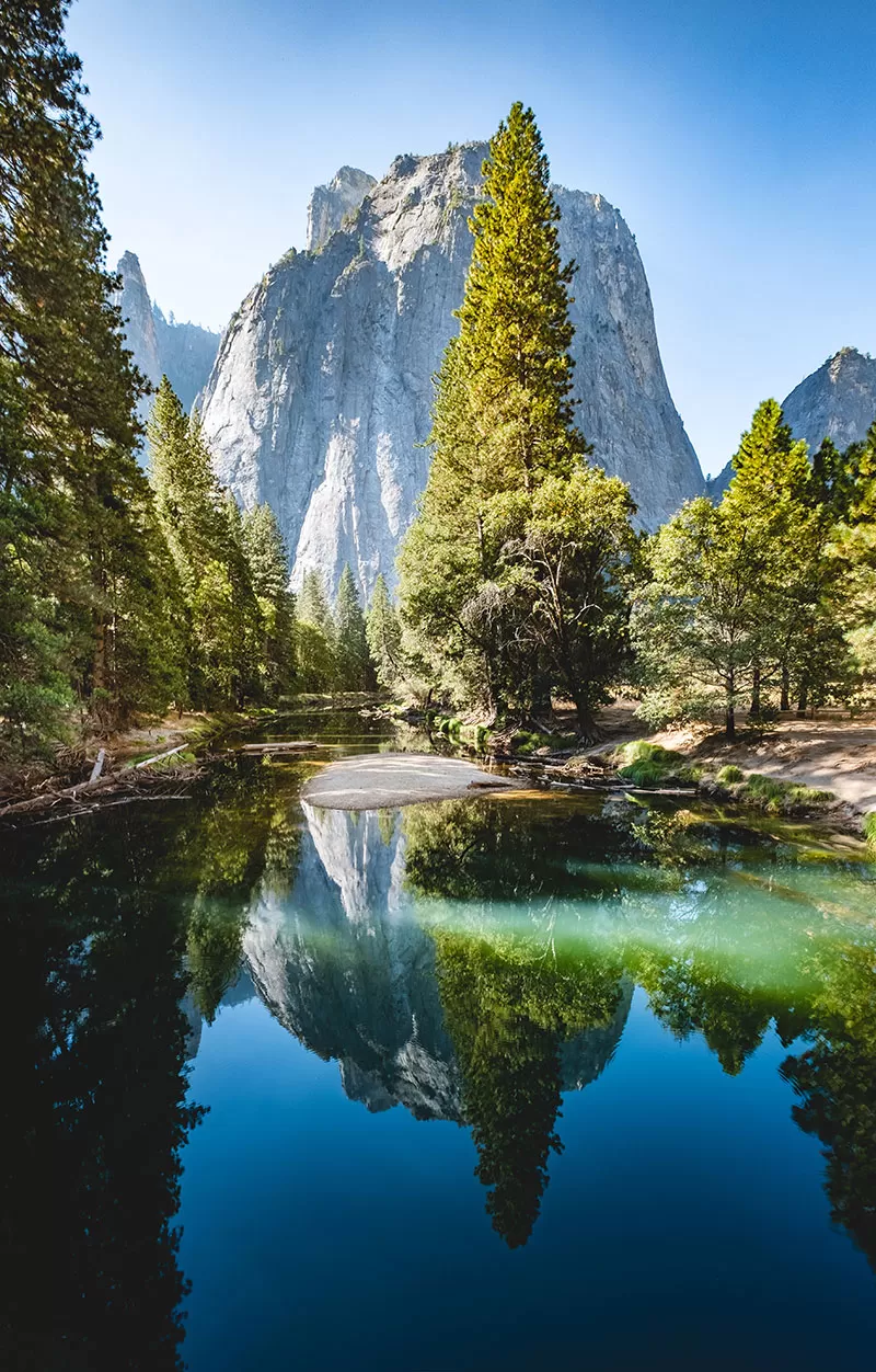
Cathedral Rocks reflecting in the river
Peer up at the beast of a monolith that is El Capitan then spin around 180 degrees and you’ll see get a great view of the equally beautiful Cathedral Rocks. If you’re lucky, you may even spot from deer grazing in the meadow.
How to get to El Capitan Bridge and El Capitan Meadow
El Capitan Bridge and El Capitan Meadow are located right near each other on Northside Drive (a one-way road) as you leave Yosemite Valley. There are plenty of opportunities to pull over and park your car and set off on foot to explore the area. Stop here when you head out of Yosemite Valley.
6. Taft Point
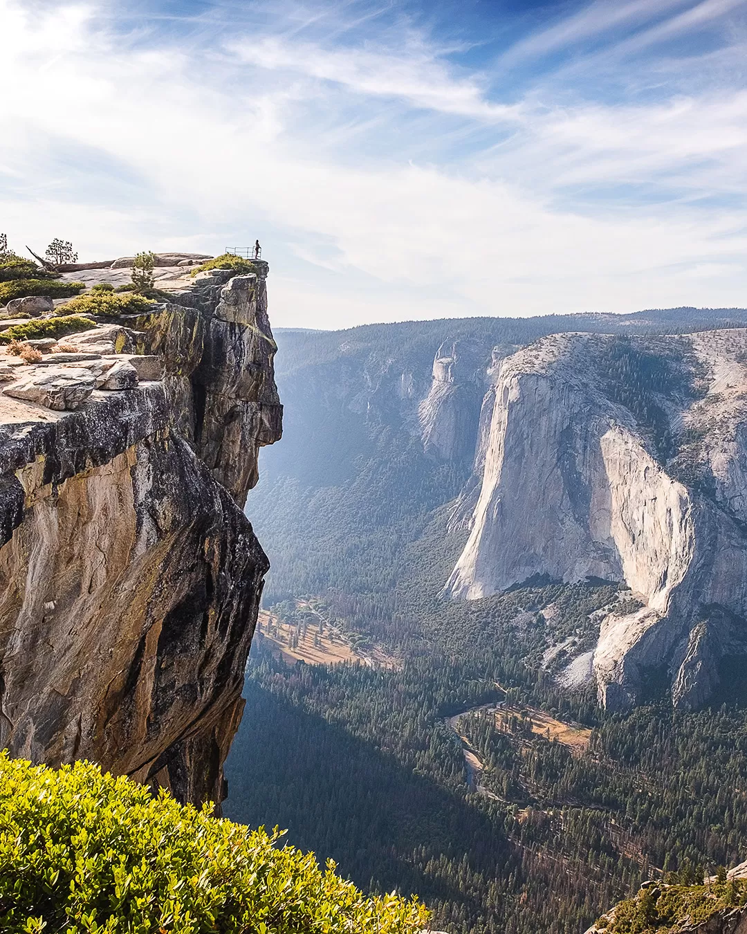
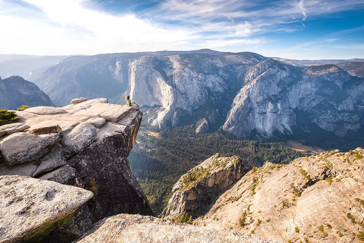 Taft Point was my absolute favourite viewpoint in Yosemite. Not only were the views spectacular, but we had the area to ourselves apart from a couple of wedding parties who arrived after us to get some incredible romantic sunset shots. From here you’ll have a wonderful vista of all of Yosemite Valley and El Capitan.
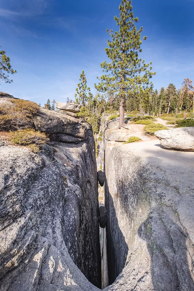
Taft Point fissures
How to get to Taft Point Trailhead
Taft Point is located on Glacier Point Road. The 2 mile (3.2 km) round trip hike from the car park will take you approximately 25 minutes to reach Taft Point.
7. Lower Yosemite Falls
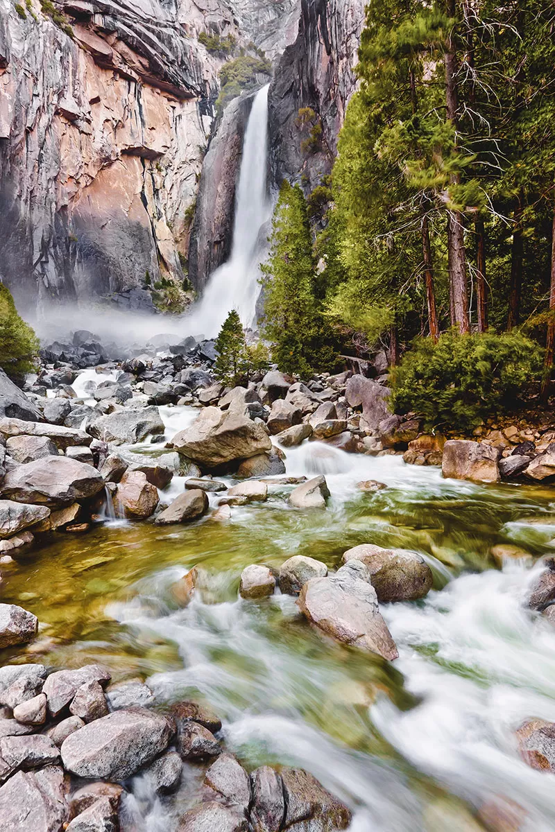 Get up close to Yosemite Falls from the Lower Yosemite Falls Trailhead. This spot is super easy to get to with a ½ mile (804 metres) paved trail that’s also suitable for wheelchairs.
If you time your trip just right to coincide with a full moon and good weather, make sure you come here at night for some truly incredible lunar photography. Why? One word. Moonbows!
I can’t begin to describe how cool this is. Just watch this…
How to Get to Lower Yosemite Falls
Lower Yosemite Falls is located just off Northside Drive between Yosemite Valley Visitor Centre and Yosemite Valley Lodge.
8. Valley View
 From the valley floor, gaze up at Yosemite Valley from this tranquil spot located on the Merced River.
How to Get to Valley View
Valley View is located on the left-hand-side of Northside Drive just after Bridal Veil Fall and immediately before Pohono Bridge. Look out for a tiny roadside car park.
9. Sentinel Bridge
To see Half Dome reflected in the Merced River, you have to make a stop by Sentinel Bridge.
How to get to Sentinel Bridge
Located on Sentinel Drive in Yosemite Valley, this short road connects both Northside and Southside Drives. Halfway along the road you’ll find the bridge.
10. Artist Point
For a more tranquil experience of Tunnel View, take the 2 mile (3.2 km) round trip trail up to Artist Point. The view, in my opinion, is slightly better since you see more of the valley floor.
How to get to Artist Point
The start of the hike to Artist Point starts in the Tunnel View parking lot. The hike takes 45 – 90 minutes and is considered to be of easy/medium dif
ficulty.
Got more time?
See Giant Sequoias at Mariposa Grove
Crane your neck to see the top of the giant sequoia trees. Just one hour south along Wawona Rd is the largest grove of sequoia trees in Yosemite. The beast of them all is the Grizzly Giant. Allow plenty of time, ideally a whole day, hiking around this beautiful area. Not to be missed is the tunnelled-out tree big enough to drive a car through!
Top 5 Tips for Visiting Yosemite National Park
- Tioga Road and Glacier Point Roads close during the winter due to snow. They usually reopen around late May. You can check current road conditions/chain requirements by calling 209/372-0200 (then 1,1).
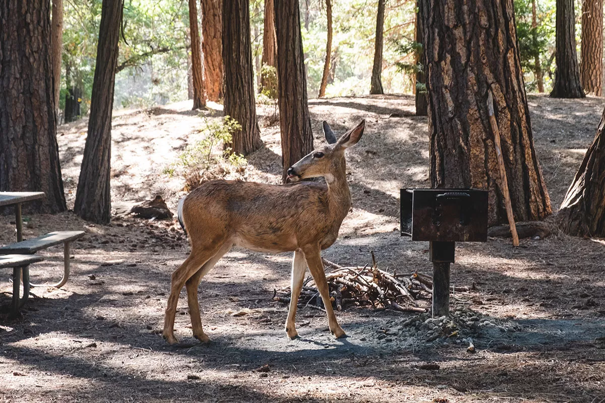
- Drive slow, there are deer and American black bears foraging with their young.
- Be respectful and stay on the marked paths to so the flora can grow back.
- Don’t keep any food, drink, lotions, perfume or any other scented product in the car or in your cabin. Bears are attracted to their scent and can/will do anything they can to get their paws on it. Always and only use the bins provided throughout the park to dispose of any food waste or rubbish.
- There is no fuel available in Yosemite Valley. Fuel is available in Wawona on Wawona Road, at Crane Flat on Big Oak Flat Road, and seasonally in Tuolumne Meadows.
Best Time to Visit Yosemite National Park
Not sure when to visit Yosemite? Every season has something unique so decide that you want to experience the most and plan your trip accordingly.
May and June – These are the best months to see Yosemite’s famous waterfalls in full force.
July and August – If hiking is your priority, then July and August are the best time months to go
September – For cooler temperatures and fewer crowds, September is a great time. Note, however, that some waterfalls (eg. Yosemite Falls) will be greatly reduced in volume or will be completely dry.
Yosemite Itineraries – What to do in 1, 2, 3, or 4 days
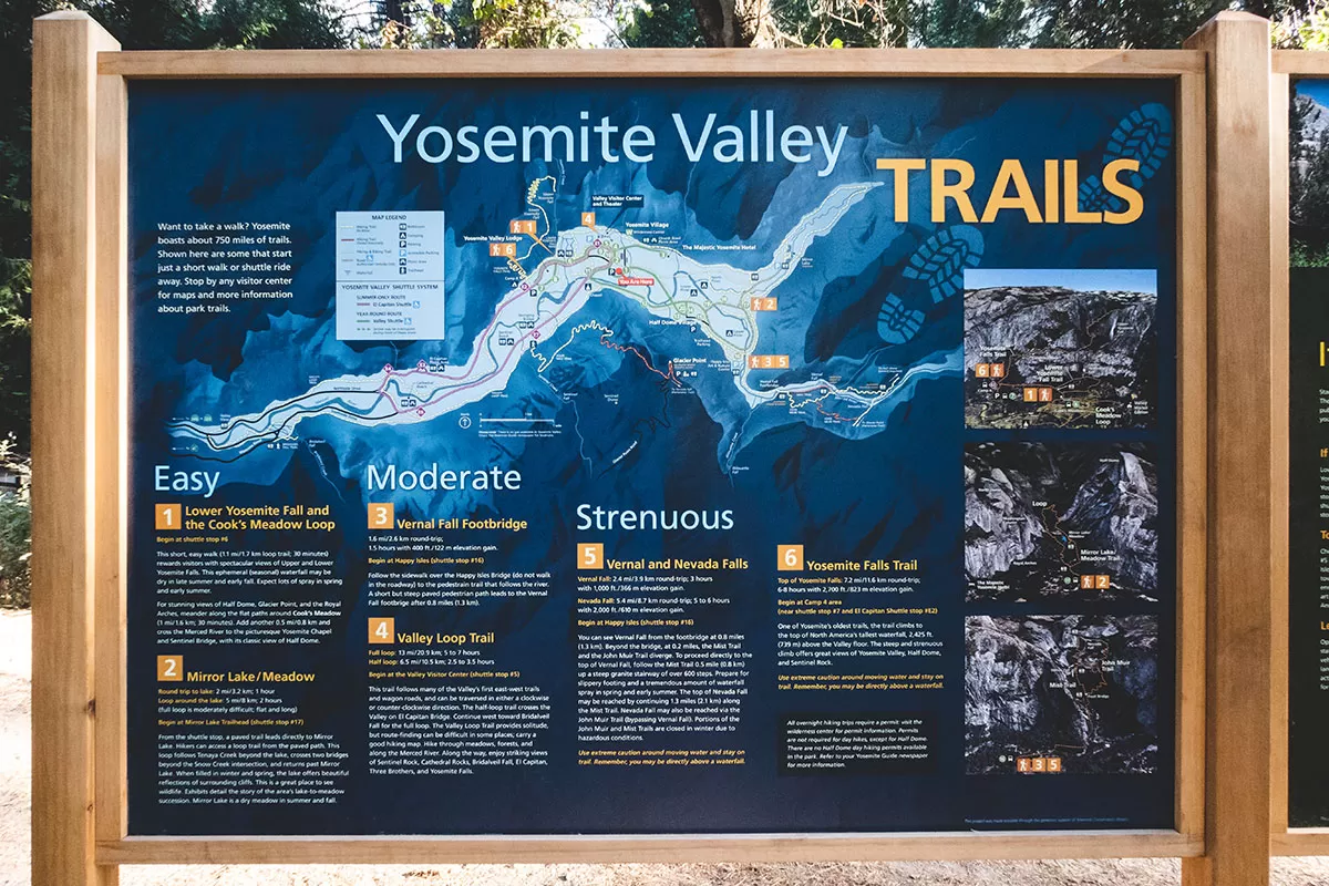
Yosemite Valley hiking trails information board
Not sure how to spend your time in Yosemite? Here are a few different itineraries to help you plan your time.
Yosemite Itinerary – 1 day
If you’re visiting San Francisco, consider taking this day trip.
Otherwise, here is a break down of what to do each day on your own.
Day 1: If you can, watch the sunrise at Tunnel View, wander around El Capitan Meadow and see Cathedral Rock, then stop by Valley View and Sentinel Bridge. Visit Taft Point, and end your day with sunset at either Washburn Point or Glacier Point or both!
Yosemite Itinerary – 2 days
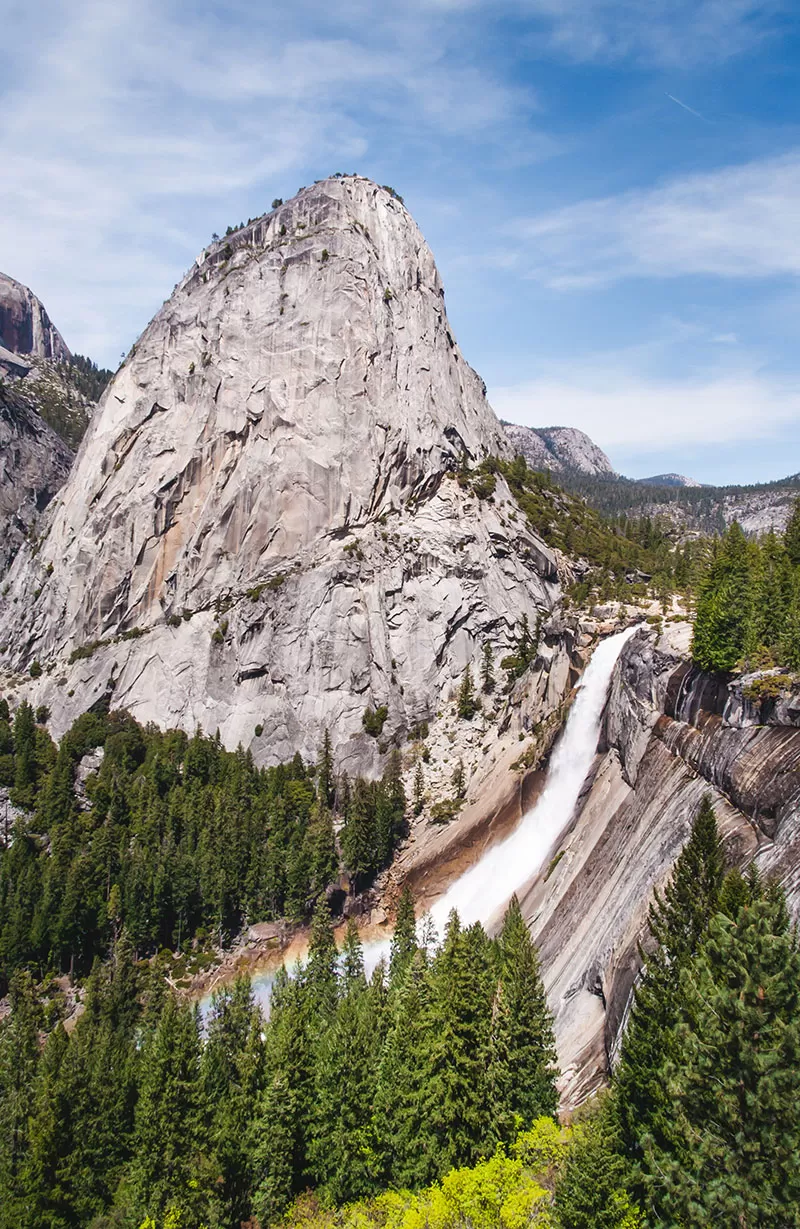
View of Liberty Cap and Nevada Falls from John Muir Trail
Day 2. Start at Lower Yosemite Falls Trailhead, then do either the Mist Trail to see Vernal and Nevada Falls. This is one of Yosemite’s most popular hiking trails and one of the easiest. Once you reach Vernal Falls you can continue on to the top of Nevada Falls or head back.
Getting to Vernal Falls: This 3.4 miles round trip hike will take you 3 – 4 hours
Getting to Nevada Falls: This 6.6 miles round trip hike will take you 5 – 6 hours
Top tip: If you’re planning you heading up to Nevada Falls, come down via the John Muir Trail for different views.
Yosemite Itinerary – 3 days
Day 3. Have a relaxing day and leave Yosemite Valley and visit Olmsted Point, Tuolumne Meadows, and Tenaya Lake.
Yosemite Itinerary 4 days
Day 4. If you’re up for a challenge but incredibly rewarding hike, then hike up Half Dome. You’ll see Vernal Falls, Nevada Falls, and wander amongst towering Sequoia trees.
Important: Note that you can’t climb the sub dome and the Half Dome cables without a permit. Half Dome permits are handed out via a lottery system.
Getting to Half Dome: This 17 hike will take you 10 – 14 hours, as I said, it’s not very strenuous.
Top tip: If you start the hike in Yosemite Valley, this trail will connect with both the Mist and the Muir Trails.
Organised Yosemite Tours from San Francisco
1-Day Yosemite National Park and Giant Sequoias Trip
2-Day Yosemite National Park Tour (including Glacier Point & Yosemite Falls)
See more tour options here.
Where to stay in Yosemite National Park
Yosemite Valley
 The heart of Yosemite is without a doubt, Yosemite Valley. Staying Yosemite Valley is the best way location from which to visit all the famous landmarks listed in this guide.
Yosemite Valley is where you’ll find all most lodging, restaurants, shops, visitor centre, hiking trails, and various viewpoints. Also here is the Yosemite Museum and the Ansel Adams Gallery. Everything is connected by one long road that loops through the entire valley.
Accommodation: Where to Stay Yosemite Valley
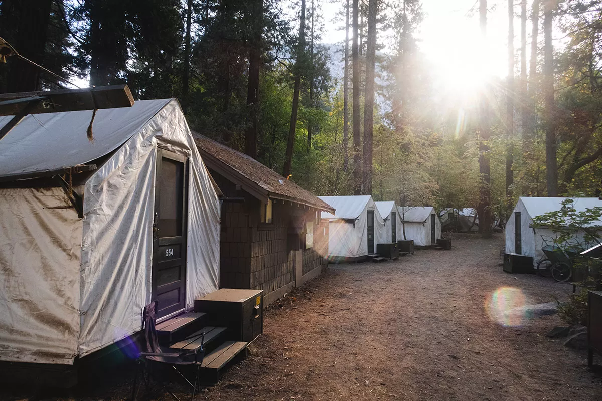
Canvas cabin tents in Half Dome Village
I stayed in a tent cabin in Half Dome Village (Formerly Curry Village) in Yosemite Valley.
I was a little slow in booking my accommodation so I ended up a cabin without heating. I was here in late September so it was a little bit cool at night but after I threw on some extra layers I was fine. It’s important to know that Tent Cabins are not heated from the Friday before Memorial weekend in May to the Monday of Labor Day weekend in September.
My tent cabin had plenty of space, with 1 double bed and 3 single beds and cost just under $160 per night. The toilets and showers are shared and located in a separate building close to the tent cabins.
Staying in Yosemite Valley was great. It made it super easy to get to each place since I was at the heart of all the places I wanted to see.
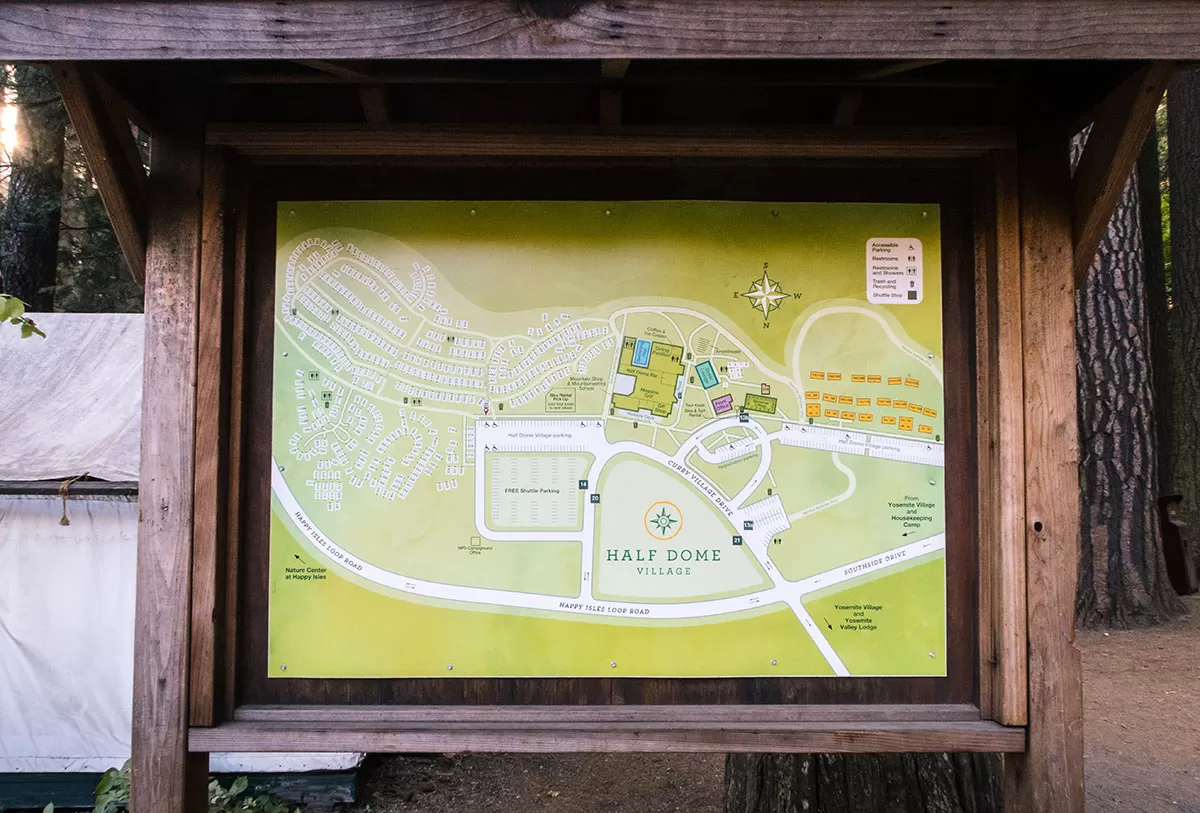
Half Dome Village Map
How Much Does it Cost? Yosemite National Park Fees
As of June 2018, there is a park entrance fee or $35 per vehicle, $30 per motorcycle and $20 per person. These passes are valid for 7 days from the time of purchase.
Visit Yosemite Park for Free
Want to save some cash? Visit Yosemite on any one of these special holidays for free entrance.
- January 21, 2019: Birthday of Martin Luther King, Jr.
- April 20, 2019: First day of National Park Week
- August 25, 2019: National Park Service Birthday
- September 28, 2019: National Public Lands Day
- November 11, 2019: Veterans Day
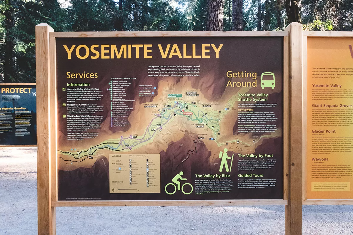
Getting Around Yosemite Valley
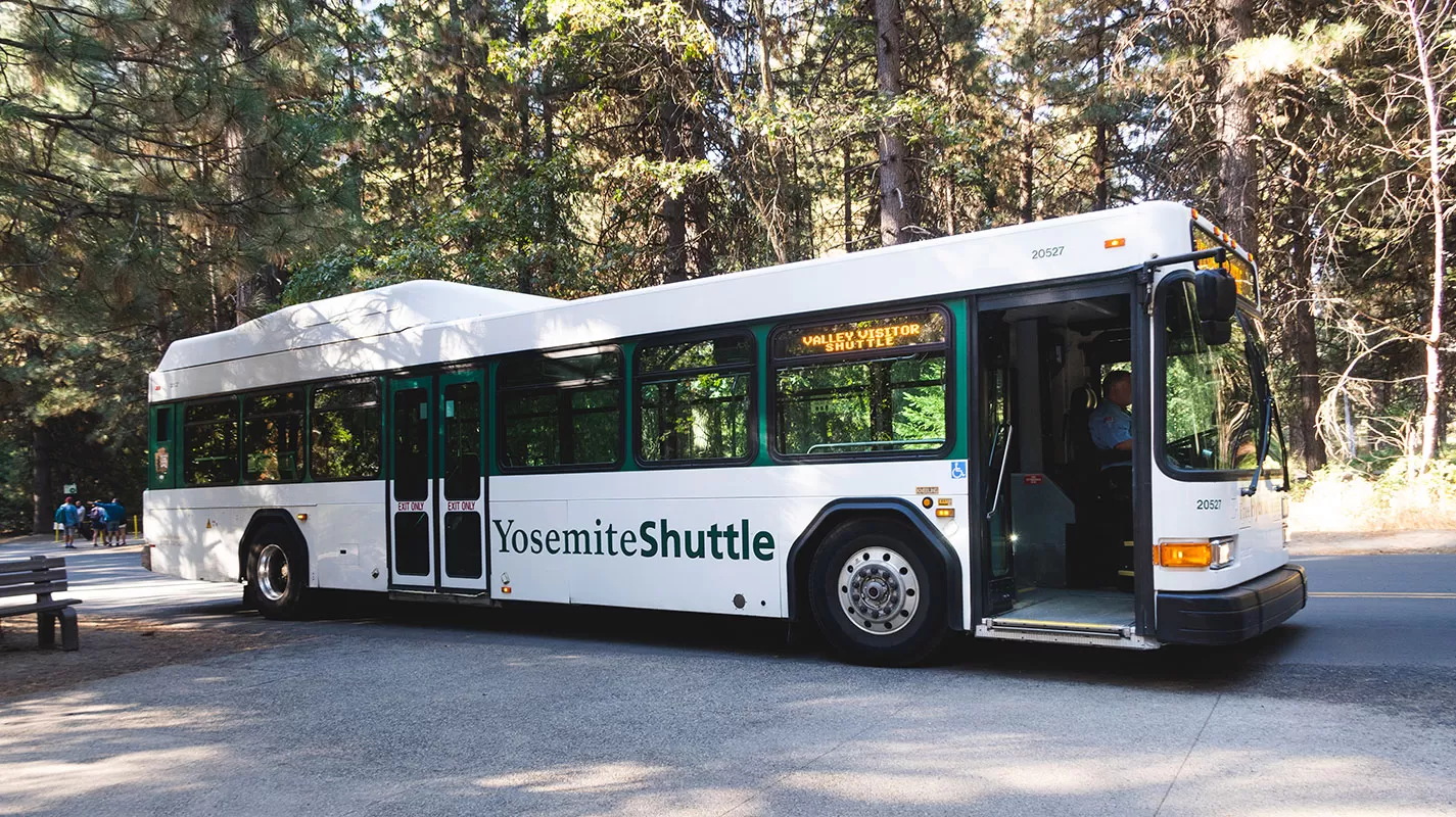 Yosemite Valley Shuttle
Yosemite Valley is very well-connected. There is a free (yes, free) shuttle bus that links most of the places listed in this guide. Just park your car and hop on the eco-friendly shuttles and hop off at any of the park’s attractions.
The Yosemite Valley shuttle system stops at or near all overnight accommodations, stores, and major viewpoints and operates all year round from 7 am to 10 pm.
Get more information about public transport in Yosemite National Park.
Car
Alternatively, hire a car so you can also drive around Yosemite at your own leisure. Keep in mind that parking can be limited but is generally ok outside of peak season. Parking is free. Just remember that there are no fuel stations within Yosemite Valley. Compare the best car rental prices here.
How to Get to Yosemite from San Francisco
Bus services
Bus services to Yosemite Valley run during summer from various cities throughout California and the rest of the United States.
- Amtrak has a combination of train and bus services to Yosemite Valley and runs limited services to White Wolf and Tuolumne Meadows every day during July and August and on weekends during June and September.
- Greyhound runs bus services to Merced, where you can transfer to YARTS to continue to Yosemite Valley. YARTS also provides limited service to Crane Flat, White Wolf, and Tuolumne Meadows every day during July and August and on weekends during June and September).
Car
Depending on traffic, the drive to Yosemite from San Francisco will take 3.5-5 hours with a distance of 195 mi / 314 km.
Take I-580 east to I-205 east to Highway 120 east (Manteca) or Highway 140 east (Merced) into Yosemite National Park. Compare the best car rental prices here.
Organised Shuttle
Servicing the San Francisco area, you can also take this Yosemite shuttle bus.
Planning a trip and need travel insurance? Get a free quote from World Nomads here.
Visiting the USA? Check out my USA travel guides
- 30 Uber Fun Things to Do in San Francisco – Ultimate 4 Day Itinerary
- Moon USA National Parks Guidebook Review: A Must for Every Park Lover
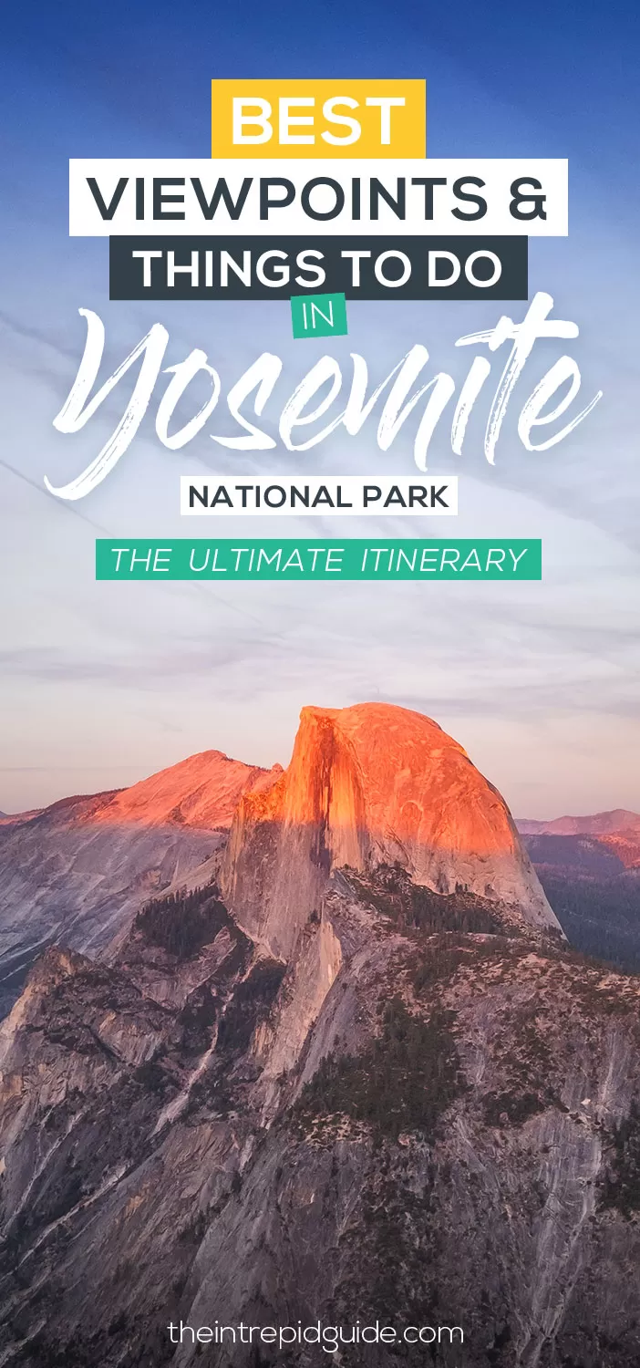
Like it? Pin it for later!
Over to you!
Do you have a question about visiting Yosemite National Park? Ask me below!
Let me know using the comments section below or join me on social media to start a conversation.
Thanks for reading and I hope you enjoyed this post.
Like what you see? Subscribe using the form below to have all of my posts delivered directly to your email.
1 comment
Your sunrise shots from Tunnel View are phenomenal!!! I actually always thought it’s Tunnel View because it’s like you’re looking along a “tunnel” through the valley…! I’ve definitely got to get back there – so I can get up for sunrise, and also because the waterfalls were pretty much dried up when we went. That took a lot out of our itinerary and we did everything we wanted to (or could) do, so a day was perfect to get to all those viewpoints! But I’d definitely go back for longer to do everything else in this post!